Joseph's Tomb: Evidence of Location
A Forensic Reconstruction Through Revelatory Documentation
Researcher: David Neufer
For the Urantia Science Symposium 2025
Introduction: Lines of Investigation
"Where have you taken the Master? Where have they laid him?" Mary Magdalene, addressing a stranger she thought "might be the caretaker of the garden," desperately sought the missing body of Jesus (189:4.10). Her question at dawn on that resurrection morning invites our investigation—where exactly was this place?
The Urantia Papers provide remarkably specific details about Joseph's tomb, details that, when carefully assembled, point toward precise geographic identification. This investigation follows five distinct trails of evidence through the revelatory account: the crucifixion route establishing our geographic baseline, the panicked flight of tomb guards revealing distance constraints, five women encountering fleeing soldiers at Damascus Gate, the temple captain's disposal of burial cloths "over a near-by cliff," and the tomb's precise specifications—dimensions, sealing system, garden setting, architectural orientation.
Each evidence trail narrows the possibilities. Combined, they converge on less than 30 acres of Jerusalem terrain. The Urantia Papers didn't merely describe a tomb; they provided forensic coordinates for those willing to carefully map the evidence.
Crucifixion Route and Timing
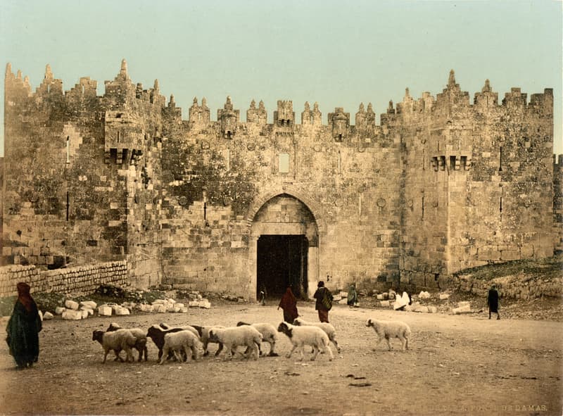
Just before nine o'clock on that Friday morning, Roman soldiers led Jesus from the praetorium toward Golgotha¹. The route selection tells us something important—while condemned criminals typically paraded through Jerusalem's longest streets for maximum public viewing, on this day they took "the most direct route to the Damascus gate, which led out of the city to the north"².
This northward procession passed through Damascus Gate and continued along the road leading toward Samaria. Following this road, they "soon arrived at Golgotha," Jerusalem's official crucifixion site³.
One detail proves particularly significant: Jesus collapsed from exhaustion "shortly after passing through the gate"⁴. At this precise location outside the city walls, the soldiers conscripted Simon of Cyrene, who happened to be stopping there with other Cyrenians⁵. Simon carried the crossbeam the remaining distance.
The journey's timeline gives us our first measurement. Departing just before nine o'clock, the procession arrived at Golgotha "shortly after nine o'clock"⁶—less than one hour total, with most of the distance covered after Jesus collapsed at Damascus Gate. This places Golgotha north of Damascus Gate, along the northward road, within a one-hour walking distance.
Guard Flight Pattern
The tomb's security arrangement involved both Roman and Jewish guards—ten soldiers provided by Pilate, supplemented by ten temple guards⁷. These professional soldiers maintained watch through standard military shifts until "the hour of the resurrection"⁸.
Critical Timing Sequence
Figure 2. Sequence of Events shows:
At 3:02 AM, Jesus emerged from the tomb in morontia form. Eight minutes later, at 3:10 AM, the archangel chief requested custody of the physical remains. After 3:10 AM, midwayers commenced the stone-rolling operation and the guards witnessed the massive stone moving "of its own accord" and fled in panic. Between 3:20 and 3:25 AM, the five women encountered these fleeing guards at Damascus Gate. The women arrived at the tomb at 3:30 AM and found the stone already rolled away.
The stone-rolling operation provides our forensic anchor. Secondary midwayers received the assignment to roll away the tomb stones¹⁵. When the guards on duty witnessed "this huge stone begin to roll away from the entrance of the tomb, apparently of its own accord—without any visible means to account for such motion—they were seized with fear and panic, and they fled in haste from the scene"¹⁶.
These were soldiers who had installed the sealing system themselves. They knew the stone's weight intimately. Their abandonment of posts after witnessing the impossible reveals professional recognition of something beyond explanation.
Distance Calculations
The guards' flight time tells us the distance. Fleeing at approximately 3:10-3:15 AM, they reached Damascus Gate by 3:20-3:25 AM—a maximum transit of 10-15 minutes. Professional soldiers moving in panic would maintain 4-5 mph, yielding a maximum distance of 1.0-1.25 miles from tomb to gate.
The Women's Journey
Five women departed for the tomb "a little before three o'clock" that Sunday morning. Mary Magdalene, Mary the mother of the Alpheus twins, Salome, Joanna, and Susanna, carried special embalming lotions and additional linen bandages¹⁷. Their purpose: to complete the burial preparations interrupted by the Sabbath.
Their direct route through Damascus Gate brought them to an unexpected encounter:
"As they passed out of the Damascus gate, they encountered a number of soldiers fleeing into the city more or less panic-stricken, and this caused them to pause for a few minutes; but when nothing more developed, they resumed their journey"¹⁸
After this brief pause, the women continued and arrived at the tomb "about half past three o'clock"¹⁹. This timing perfectly aligns with the guards' flight pattern—the soldiers had just enough time to reach Damascus Gate before the women passed through.
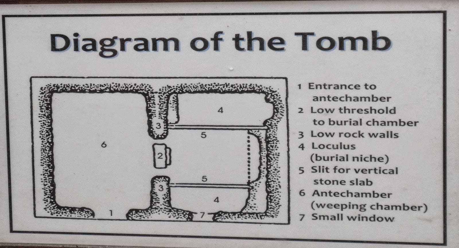
Tomb Specifications from Revealed Text
The revelation provides precise details about the burial site. Joseph and Nicodemus had selected "Joseph's new family tomb, hewn out of solid rock, located a short distance north of Golgotha and across the road leading to Samaria"²⁰.
Physical Dimensions and Features:
- Chamber "about ten feet square" (~100 square feet)²¹
- Interior shelf for body placement²²
- Dual-stone sealing system (large circular + smaller stone)²³
- Primary stone "moved in a groove chiseled out of the rock"²⁴
- Located "in his garden on the hillside"²⁵
- Tomb "faced toward the east"²⁶ (burial chamber orientation)
The architectural arrangement proved significant for the discovery. The eastern orientation of the burial chamber allowed natural dawn illumination when Mary looked inside: "By this hour there was just enough of the dawn of a new day to enable Mary to look back to the place where the Master's body had lain and to discern that it was gone"²⁷. The eastern-facing chamber permitted morning light to reveal the empty shelf where Jesus had been placed.
The burial procession confirm accessibility. They "started from Golgotha for Joseph's tomb across the way" at approximately 4:30 PM Friday²⁸, demonstrating reasonable proximity for those bearing a body.
The Shroud Disposal Cliff
A revealing detail emerges from the cover-up attempt. After Joseph and David Zebedee inspected the empty tomb Sunday morning, confirming what the women reported, "they were the last to so view the sepulchre, for the high priest sent the captain of the temple guards to the tomb at half past seven o'clock to remove the grave cloths"²⁹.
The disposal method proves geologically significant: "The captain wrapped them all up in the linen sheet and threw them over a near-by cliff"³⁰.
Geographic Requirements:
- Cliff is within walking distance of the tomb
- Sufficient depth for disposal concealment
- "Near-by" designation indicates reasonable proximity
- Accessible to the temple guard captain
- Complex terrain supporting multiple cliff formations
Rather than investigating the extraordinary tomb conditions, religious authorities prioritized evidence elimination—inadvertently providing another geographic constraint for our investigation.
Location Constraints Summary
The forensic evidence creates six categories of requirements:
Convergent Geographic Parameters:
- Distance: Maximum 1.25 miles from Damascus Gate
- Direction: North of Golgotha, east of Samaria road
- Geology: Solid rock for hewn chambers, nearby disposal cliff
- Dimensions: ~100 square feet chamber with shelf and groove system
- Setting: Garden on hillside with cultivation capability
- Access: Multiple approach routes for different parties
These converging constraints reduce viable locations to approximately 0.05 square miles of highly specific terrain north of Damascus Gate. The tomb must satisfy all requirements simultaneously—a remarkably precise set of coordinates hidden within the narrative details.
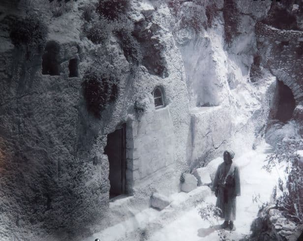
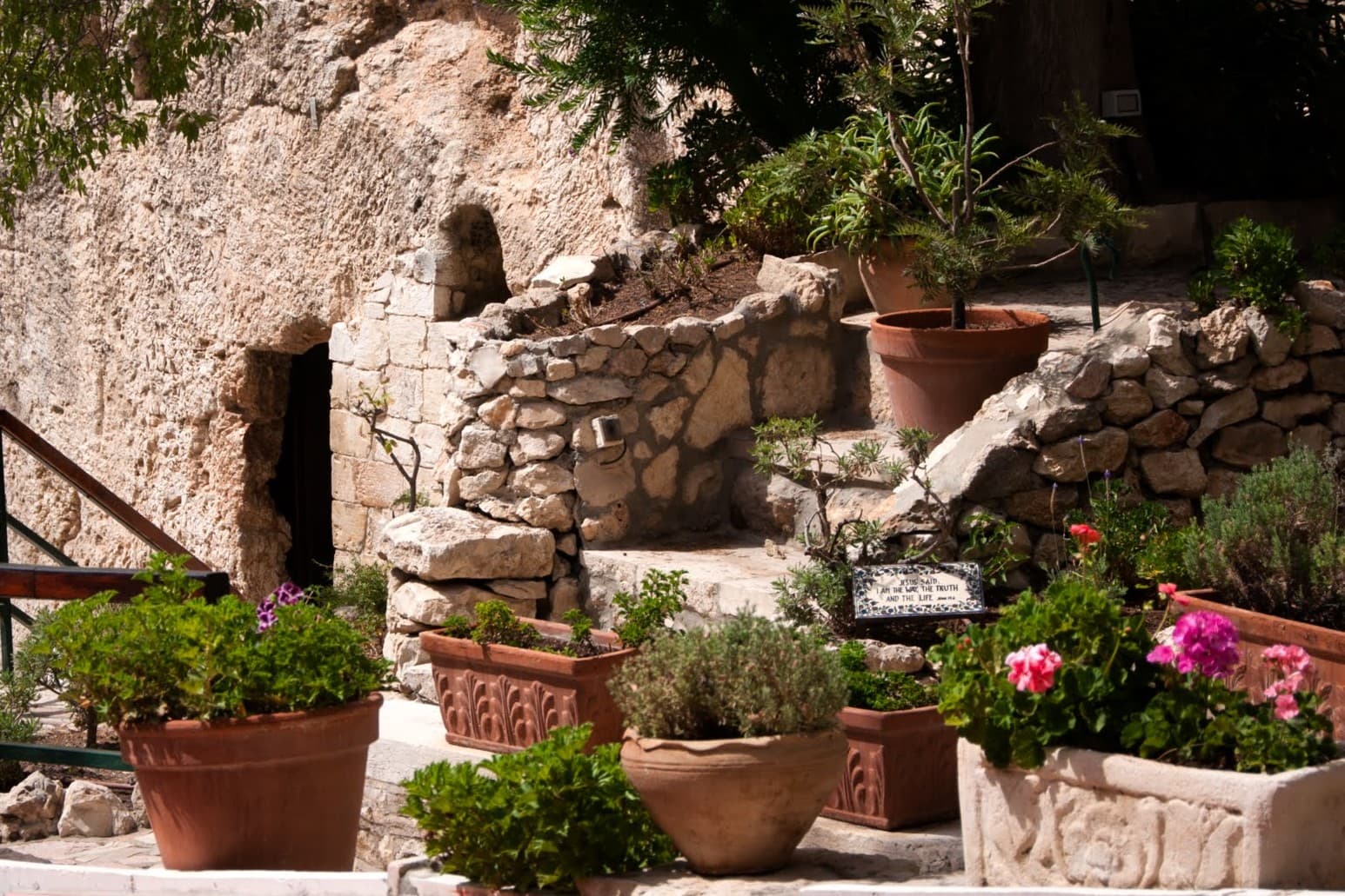
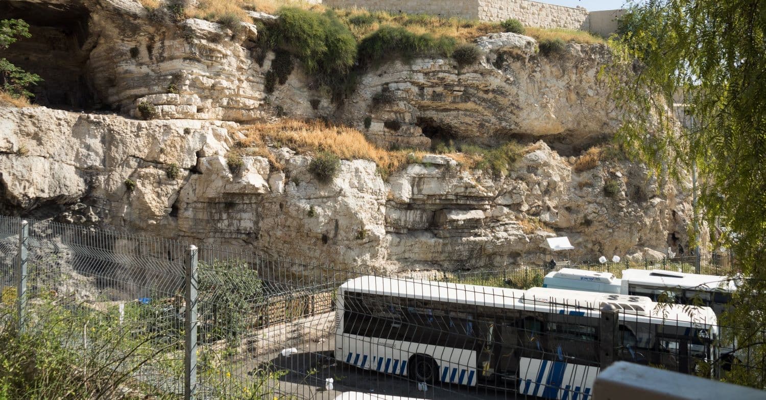
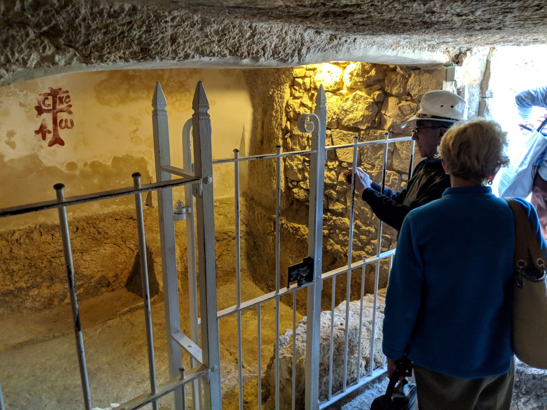
The Garden Tomb
The Garden Tomb, known to Jerusalem visitors since the 1890s and well-established by the 1920s-1930s revelation period, matches our forensic requirements with remarkable precision.
Specification Compliance Assessment
Figure 7. Garden Tomb Compliance Chart shows:
The Garden Tomb is located 0.7 miles northeast of Damascus Gate, well within the 1.25 mile limit. The chamber dimensions measure 8 feet by 11 feet, equaling 88 square feet—an 88% correlation with the specified "about ten feet square." The tomb is confirmed to be carved from a limestone cliff with rock-hewn construction. Its architecture features a vestibule entrance facing north and a burial chamber facing east, allowing dawn illumination into the chamber as described. The site has a documented historical garden designation. Multiple nearby ravines and cliffs provide disposal capability for the burial cloths. A visible channel for the rolling stone remains preserved in the groove system. All seven specifications match the Garden Tomb's physical reality.
The 88% dimensional correlation stands out. Ancient construction tolerances make this precision remarkable—especially given the phrase "about ten feet square" allows reasonable variation. Such correlation exceeds coincidental probability.
Correlation Review
Consider the pattern: The revelators had access to all known Jerusalem tomb sites during the 1920s-1930s composition period. They specifically employed garden-related terminology while providing measurable specifications. Why specify "ten feet square" unless confirming a measurable reality? Why emphasize the garden setting unless it is to validate a known location? Why detail the groove mechanism unless it remained visible?
The evidence suggests intentional verification: the revelators confirmed what careful investigators would discover—that the Garden Tomb satisfies every requirement with uncanny precision.
Archaeological Implications
This forensic analysis reveals a remarkable aspect of the Urantia Papers—they function as an archaeological database when approached in a methodical manner. The precision achieved through constraint assessment validates treating revealed information as historical sources worthy of serious investigation.
The convergent evidence patterns indicate preservation of accurate geographic, temporal, and physical information across multiple narrative streams. Such precision significantly exceeds what random correlation would produce.
The Garden Tomb emerges not through speculation, but through the fulfillment of multiple independent requirements. Priority archaeological investigation of the site's precise specifications and the nearby disposal cliff could provide definitive correlation confirmation, potentially establishing new protocols for evidence-based revelatory archaeology.
Conclusion: Geographic and Spiritual Significance
The forensic evidence converges on a specific location—the Garden Tomb, with its 88% dimensional match, proper geological features, and precise distance from Damascus Gate. The revelation appears to have deliberately confirmed this site through specifications unknown to 1890s archaeology, yet verifiable today.
Mary's question—"Where have they laid him?"—finds its answer through careful investigation. But this marks more than geographic coordinates. It identifies the precise location where the risen Jesus emerged from mortal constraints, where divine purpose operated through natural law rather than against it. The empty tomb stands as material proof that personality transcends death, that consciousness directs matter, that universe administration achieves its purposes through ordered processes.
Mary addressed her question to one she thought was the garden's caretaker, not realizing she had spoken to the risen Master himself. Today, through the forensic reconstruction of revealed evidence, that garden can be identified—transforming her desperate question into a geographic understanding, mystery into a mappable reality.
Researcher: David Neufer
For the Urantia Science Symposium 2025
AI Disclosure
This forensic investigation was conducted by David Neufer with assistance from Claude AI for systematic evidence coordination, citation verification, and document structuring. The AI assisted with cross-referencing, identifying relevant passages, organizing constraint categories, and ensuring citation accuracy. All forensic methodology, interpretive analysis, hypothesis development, and investigative conclusions are derived from human research and the interpretation of revealed evidence. The geographic correlations, constraint derivations, and final assessments represent human analysis of revelatory documentation. The research methodology, conceptual breakthroughs, and final responsibility rest entirely with the Researcher.
Speculation Boundaries: Where analysis extends beyond explicit textual evidence into a forensic hypothesis, such extensions are clearly indicated through conditional language and explicit notation.